Tuesday, August 14, 2018

NEMAC Timeline Part 3 January 21, 2015

The Mayor's Memorandum included a convenient timeline highlighting a period in which the county stopped considering the question of incorporation.

Over 6 years

I don't know if the NEMAC completed their study by April of 2005, but since it doesn't appear in the timeline I assume as much. The Board of County Commissioners established a moratorium on incorporation in November of 2005. A moratorium prohibits an activity. (Like President Obama's 2010 moratorium on offshore drilling.)
In 2012 the BCC changed its mind and lifted the moratorium. Two and a half years later Commissioner Heyman reintroduced the NEMAC officially. However according the the Mayor's Memorandum the NEMAC reconvened February 2013, almost two years before.
To this date I have not discovered under whose authority they met, nor who called any of these meeting, but I have inquired with county staff.
I also await the minutes for these NEMAC meetings. Hopefully those can address some of these concerns.
On to the Resolution!

East and North to Highland Oaks Neighborhood Walk Around August 14, 2018

As I planned, on my walk today I traveled East into the single family residential neighborhood. I didn't walk yesterday due to the rainy weather. Likely in the future I won't skip my walk on account of rain.

While I took many photos I didn't necessarily do a lot of noticing because I did not have familiarity with much of what I came across. I live pretty close to where I usually work, but I tend to take the same route every day.
I availed myself to the chance of seeing places I hadn't before. For the most part I let the incorporation signs guide me!
So expect to see a bunch of those, and some random other thoughts. Press on an image 


Look at these dipping swales! I wonder how much higher the road is than the first floor of the condominiums on the north side of 191st Street. Also notice how much the driveway drips fro the street to the parking lot.


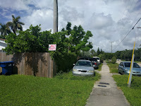
This part of the neighborhood has terrible car problems. Not only do we drive 30 mph down a high density residential street, with virtually no pedestrian crossing ability, but condos have given up lawn space, an sometimes cars resort to parking in the county swale.


The first NO sign I noticed on my walk. I've seen it hundreds of times, so it blend in to the scenery for me at this point. I wonder if the condominium association board approved the placement of this sign.

I also noticed this second tower above the building 1701. It has the same style of the other tower at the building center.

My block ends at a T. On Thursday's walk I went right so today I turned left.

The first YES sign on the walk. More of both to come.


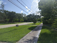
This street corner has amazing shade from these two trees in the swale. Compare it to the shade-free places around it. I love tree cover! (Though make sure they're properly maintained.)
Organic bananas anyone?

Look at these hanging pods!

This tree took my breath away. What an attention hog!


I always wondered about this odd driveway situated just off Ives Dairy Road. It connects to at least five properties. One of them with the NO sign in the previous image.

I didn't want to stand in the middle of the road to take this image, but there's debris from a crash right in the middle. Ives Dairy and NE 24th is a traffic nightmare.

After stopping in at Highland Oaks Middle to say hello to some staff, I went right on my way home. Look how traffic gets stuck at 10:35 am on a Tuesday. 

After crossing the street on my walk signal I took this picture to show how traffic from over 30 seconds ago still hadn't moved. 

Though on private properties, this is one of the only views I have seen of any of the lakes surrounded by private single family residences. I wish the lakes were a bit more accessible to the comm.


Seems even video cameras didn't stop thieves from taking a couple bicycle wheels. Never leave bicycles in publicly visible places without having all easily detachable components under lock, preferably a metal U-Lock.

Aside from the all-access guard gates, I don't know any other entrances to this part of the neighborhood, but one could easily traverse this fence. 


Another one of these bodies of water which take up a significant portion of the surface area around here.

Yes sign on the left
The truck in the middle actually covers up a third YES sign. Bad timing on my part.
Based only on this walk around my neighborhood I think most people with an opinion support incorporation. I will continue to photograph signs I find throughout my walks. Perhaps I'll upgrade to bicycling soon so I can get a little further, like down to West Dixie, or up to 215th.

Saturday, August 11, 2018

Neighborhood Walk Around August 8,9, 2018

I decided to start walking daily to get fresh sunlight while awaiting my work year to start. As a typical millennial I couldn't help taking pictures of anything that caught my attention. Given my recent strong of posts regarding incorporation I couldn't help fixating on thoughts of what the county doesn't do well that a city might accomplish more efficiently and effectively. I invite you to spy some untypical views of my community, and my thoughts of them. On these two walks (Thursday and Friday) I went south so Skylake Plaza,  and back. 
On Monday I will instead walk east towards the single family neighborhood.

Thursday

I recently met with members of the Sky Lake and Highland Lakes Area Home Owners Association and one of them mentioned a past effort to prevent construction of a communications tower. I told them that one of the buildings on my block does have a communications tower in it. Someone told me they receive substantial compensation for the lease of the space.
As a private condominium details of the contract like do not fall under any kind of public records laws.

As I walked south on 18th Avenue I saw something very familiar, but which now had a different context for me, however first notice a parking space next to this pump station.
In the resolution on Northeast incorporation the county demands retention of four pump stations. It seems the county did not include this one as per the addresses in the resolution included here.

I found this pump station between 191st and Miami Gardens Drive, well south of 19720 NE 18 Avenue.
This circumstance immediately raises the question of why the county wants some pumps and not others.


Many of these NO signs went up several years ago. The Yes campaign only recently got their act together and have a much prettier design. I will feature such an image when I find one.

I have a great interest in mass transit. Seeing a handful of people at a bus stop speaks volumes to me. These people waited in front of Skylake Plaze at 2:05pm on a Thursday. I recall a very hot day. I wonder how much residents, employees, and visitors use mass transit in our neighborhood.

The most recent development in my immediate area.

It looks as though we lost a gas station and gained another bank. I find gas in this area too expensive and did not frequent that station.


More NO signs in front of a condominium. I wonder if the boards of these respective places approved these signs. 


When eastbound traffic at the intersection of Miami Gardens Drive and NE 15th u-turn vehicles regularly drive onto the swale, creating this desert next to a patch of grass.
If I understand correctly Florida Department of Transit has jurisdiction of Miami Gardens Drive, rendering both the county and any potential city unable to directly address the design issues which generate these kinds of problems.

I crossed the street to acquire this photo as it features the largest buildings in the Northeast. Buckley towers in the background has a twin out of view behind it. Both buildings have more than the 8 floors in the much newer Sky Lofts.

I photographed this image to remind myself to learn more about the public works project highlighted in the poster near the center of the photo. Consent Decree (meaning there was no discussion or debate) Project #4.09(2) Furnish and Install 12" DI & 16" HDPE Pipe from Miami Garden (sic) Dr. along NE 14th Avenue to Station No. 0455.
I can't make out the last line in the photo stating the Project #.

I presume they installed that pipe on the east side of 14th Avenue.

The ducks hang out here. I wish people wouldn't feed them. They don't need your food as they have evolved over millions of years to find their own food. Ducks crossing the street to eat food left in the grass regularly die from car collisions.

When I first moved to the area people did not park on the swale to the west side of 14th Avenue. I only found two cars this time, but likely many more after 6pm. 

 Trash along the west side of 14th Ave., a small sampling.


Lack of available parking in the condominium lots also lead to many cars left in the swale on the north side of the bridge on 14th Avenue. 

Another pump station. Also not included in the county's demands for incorporation.

 Friday

Open utility box.

I found this along 14th Avenue. (I went counter clockwise on Friday)
Telecommunications companies use fiber optics to transmit large amounts of data. Homes and buildings equipped with fiber optic wiring can take advantage of this technology for some of the fastest internet speeds available to regular consumers. 

I stopped at the bridge on 14th Avenue to create a panoramic of this water. Under me the water runs east towards the ocean. I don't know the name of this body of water, or if humans made it. I would love to see the border areas which aren't accessible by people converted to some kind of swampy forest to get more plant life and water retention. 

I took no more photos Friday as I saw all the same things. Thank you for sharing my walk!

Virgin Trains Brightline Bait & Switch

Something that concerned me greatly when Miami-Dade County decided to fund the purchase and construction of a train station for the private ...